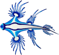
Our crossing from the Marquesas to Hawai'i was ideal. We had good wind, the waves were not too high and we did not see any signs of the ITCZ (Inter Tropical Convergence Zone), in which there can be no wind up to strong squalls, thunderstorms and a lot of rain. After the first two days, which were pretty rough, we had only sunshine, good wind from the right direction and the trade winds, which usually blow between 20 and 25 knots from the northeast in the north of the equator, were with 15 knots just strong enough to make good sailing.
We reached Hilo on the 3rd of May and anchored in Reeds Bay. Since we have been in contact with the customs and border protection for a few days before our arrival, and they had all our papers, the immigration and customs formalities were very easy and friendly.
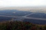
Exactly on the day of our arrival a few earthquakes happened and the first fissure on the east side of the Kilauea volcano opened up and lava started to flow out in the middle of a residential area. So we just got there in time to see some volcanic activity close up.
The biggest of the Hawai'ian Islands is named Hawai'i but is mostly called „Big Island“. It is made out of five volcanoes, two of them regularly active and one of them only dormant, which means it could be active again. The most famous is Kilauea, which has been continuously active since 1982 and is known for the lavalake of the Halema'uma'u crater.
On our second day in Hilo we had to visit the harbor master to get a temporary mooring permit. He was excited because there had been a strong earthquake at noon. It was with 6.9 the strongest one since the 70ies and all the buildings in Hilo started to shake and a mini-tsunami (app. 30 cm) happened. We did not feel anything on the boat and were surprised by the news.
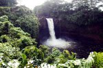
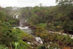
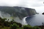
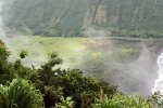
While exploring Big Island we visited the bay of Lapahoehoe, which was destroyed in 1946 by a strong tsunami. The whole village as well as the school with 19 students and five teachers was swept away. A few people survived and you can read all about their survival stories in the Tsunami Museum of downtown Hilo. After that we visited the beautiful Waipi'o Valley, one of two steep and long valleys on the island. Waipi'o, which means „curved water“, is known as the „Valley of the Kings“ because it was home to many early Hawai'ian rulers. Today the valley is private and mainly used for taro farming. The view across the valley is beautiful with the black sand beach and the waterfalls in the back.
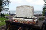
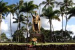
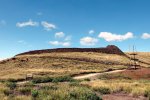
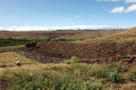
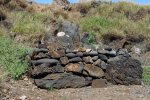
If you want to know about the history of the island you should visit Pu'ukohola Heiau. It was built by the first king of all of Hawai'i, Kamehameha the Great, as a temple for the war god. In 1790 Kamehameha successfully invaded Maui, Lana'i and Moloka'i and when he returned to Hawai'i he also wanted to rule over all of Big Island. According to a prophesy he would only rule over all of the island when he would built a large heiau – temple – dedicated to the war god. Kamehameha set to work immediately and within a year and with thousands of workers was able to finish the heiau. At the opening ceremony he also invited his rival king Keoua, who was slain in a scuffle when he arrived. By 1810 Kamehameha was indeed the ruler and revered king of all the Hawai'ian Islands.
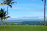
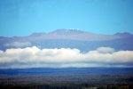
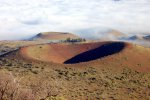
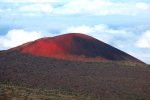
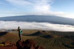
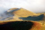
When visiting Big Island a visit of the Mauna kea is recommended, the highest mountain in the world measured from the bottom of the sea floor (app. 10.000 m). The visitor center is in 2.850 m and at night you can look through telescopes into space. Since its high elevation - the summit is at 4.205 m - dry environment and stable airflow, the summit is one of the best sites in the world for astronomical observation. The Mauna-Kea-Observatories are the largest group of observatories in the world. Made up from telescopes of 11 countries, including the Keck-observatory, which has one of the biggest telescopes in the world with two 10-meter mirrors. That’s why in Hilo all public lights (in the harbor, on the streets) have special lamps which can be easily located and taken out of measurements.
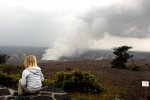
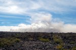
The highlight on Big Island is a visit of the Volcano National Park, which is located around the summit of the Kilauea. The Kilauea is a shield volcano located on the eastern side of Mauna Loa, the second currently active volcano. Since the big earthquake and the vanishing of the lava lake of the Halema'uma'u crater, it was clear that the National Park had to be closed at some point. We were lucky and got to see the caldera of Kilauea on the last open day. No lava was visible but the Halema'uma'u crater was smoking a lot. At that time more and more fissures were opening up on the eastern side of Kilauea and were destroying home after home. So over 2.000 people had to be evacuated and leave their houses.
Since the lava level was sinking rapidly the walls of the crater were getting more and more unstable. Once the lava level would sink under the water level, water would get in contact with the hot lava and start to explode. As long as the empty lava tunnel is open the pressure can get out. But since the walls were unstable a lot of rocks were falling into the tunnel and blocking it. So the pressure rises and at some point there will be an explosion of rocks around the crater. That was what the scientists were expecting and the reason of the National Park closure. A week after the closure just as predicted, the first explosion was seen on the summit of Kilauea.
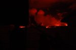
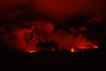
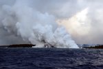
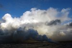
Our Hawai'ian friend Kiko, a boatbuilder and known to most people on Big Island, came one day with news from the lava streams leaking out of the fissures. Two of them were supposed to reach the ocean in a few hours and he told us to sail there and look at this amazing spectacle. So we decided to leave in the evening and sail down to the southeast side of the island, approximately 35 nautical miles. After we left the harbor area we were able to already see an orange glow in the night sky, which is made by the lava fountains. The sailing down was pretty rough but we were able to see the first lava flow before we reached the cape. Finally we could see the big “laze cloud”. Laze develops when lava comes in contact with seawater and consists of fumes of hydrochloric acid and small glas particles. Because of the constant and strong trade winds from the northeast we were able to keep out of this toxic cloud. We did not want to get too close to the lava flow anyway because one never knows how fare the lava sprays. We were the first ones to see this spectacle live. It was an incredible and amazing experience and the second boat only arrived in the morning.
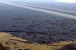
After our first trip we even had to pass the lava flow for a second time on our way to the western side of the island. The second time we were able to see a huge lava stream running into the ocean and small lava explosions at the entrance into the water.
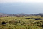
The situation calmed down for the moment after destroying over 700 homes and building up areas of new land. But if it is really over or only stopped for the moment nobody knows. After the lava vanished from the Halema’uma’u crater, it got unstable and started to collapse. This started the lava fissures on the eastern part of the Kilauea. The Kilauea is one of the most active volcanoes in the world and therefor situations like this one will develop once in a while. Although this is no help for all the people who have lost their homes. Because the Kilauea is also the most known volcano in the world there were no deaths or even injuries and the development of the situation was and is known by the scientists very accurate. The most disturbing part for the people not living in the fissure zone is definitely the so called “vog”. This looks like fog but consists of ash particles, sulfide and other gases. At the western side of Big Island we experienced this “vog” and could not see the sun properly for days.
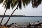
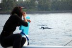
On the western side you can find a lot of beautiful anchorages and in all the bays we saw spinner dolphins, which rest there during the day. In the evening they leave for the open ocean where they mainly hunt for fish and squid. The coral coverage is not very good and we could see that the coral bleaching from last year also effected them. We also did not see a lot of fish on the reefs. Most of them were very little which could mean that the bigger ones are fished out. We also did not see any sharks except a few baby white tipped reefsharks.
Finally we had enough of the “haze” and set sail towards Maui, where we would hopefully see the sun again.


_and_the_summit_(4205m)_of_Maunakea.jpg)
.jpg)
_resting_around_the_boat_at_our_anchorage.jpg)
_from_our_ocean_anchorage.jpg)
_is_found_everywhere_but_was_introduced_on_the_islands_from_Madagascar.jpg)
 >>planned route - join us ...