
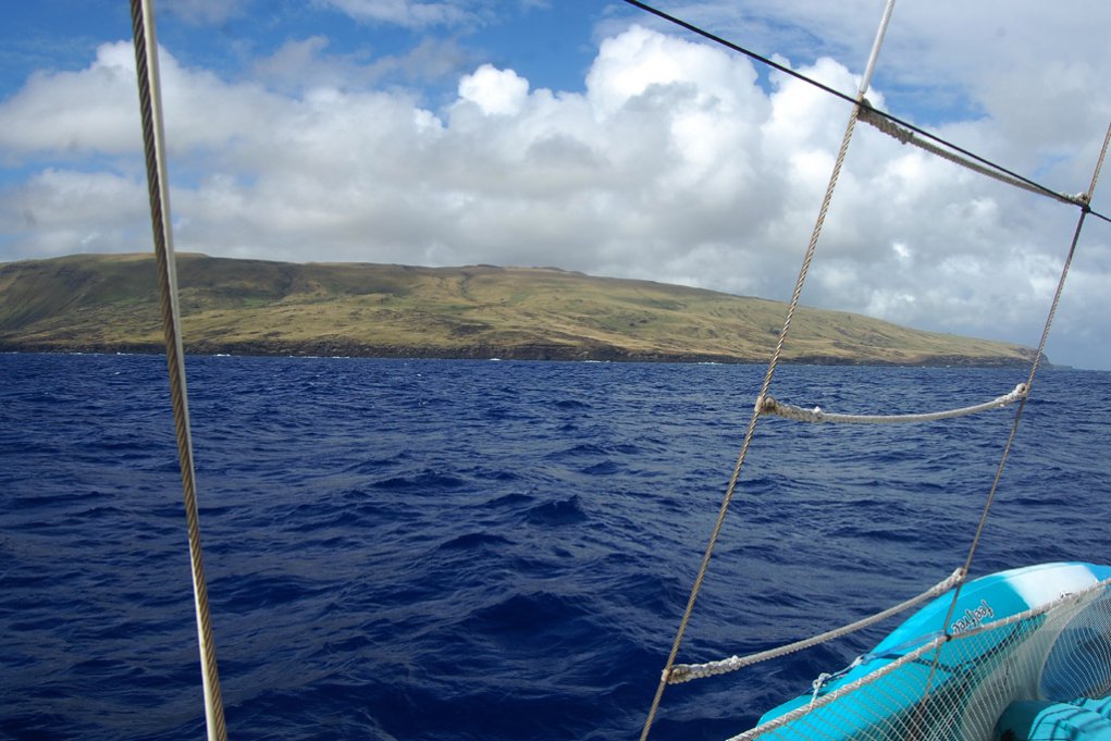
After leaving Galapagos we started to head south towards Easter Island. It was already late in the season to go down south and so we were not sure if we would make it, since at this time in the year bad weather frontal systems are the norm. The plan was that in case of one of those systems would head our way we would just turn towards French Polynesia. But we were lucky and wind as well as sunny weather made it possible to reach Easter Island in 7 days. Easter Island (Isla de Pascual or Rapa Nui) lies isolated in the southern Pacific and belongs to Chile. The next inhabited island is Pitcairn which is 2.086 km to the west. So after Tristan di Cunha it is the most remote island in the world. For the first Polynesian settlers with their fascinating history the island is the „navel of the world“.
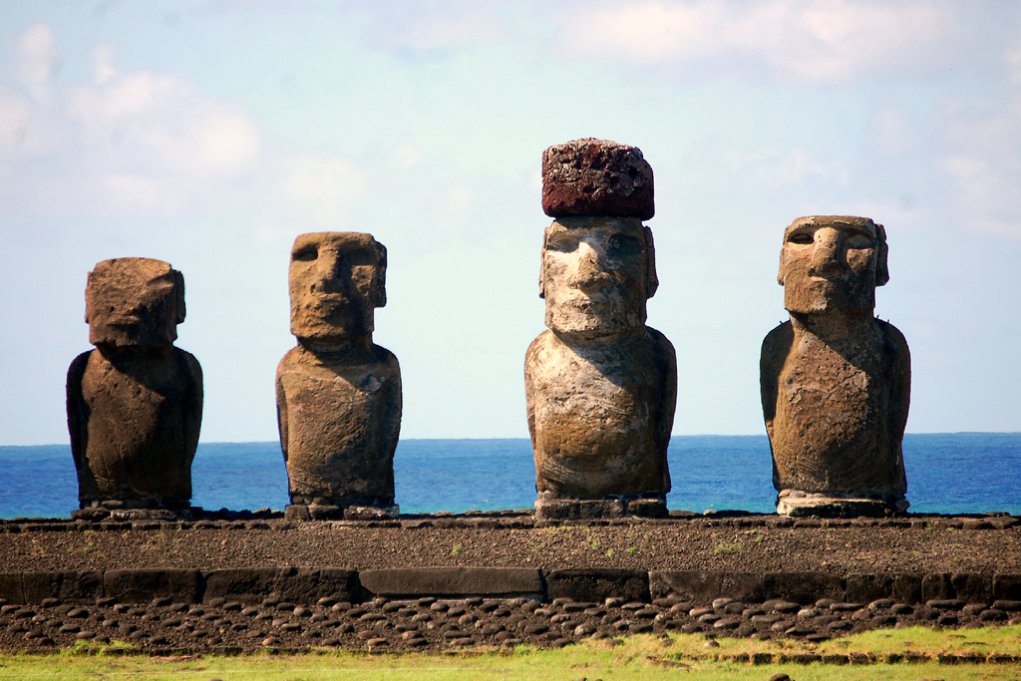
It is well known for the hundreds of stone statues called Moai, which are scattered around the island, and since the movie „Rapa Nui“ from 1994 people worldwide know of it's existence. The movie itself was a spectacular failure, but it changed the life of the people on Rapa Nui enormously and was the single most significant change in the way of life in the last 50 years. With the money made of the filming the people were able to afford cars and electronic goods for the first time and it helped to make their living situation better. Since then more and more tourists arrive at Rapa to see the famous Moai in this huge open air museum.
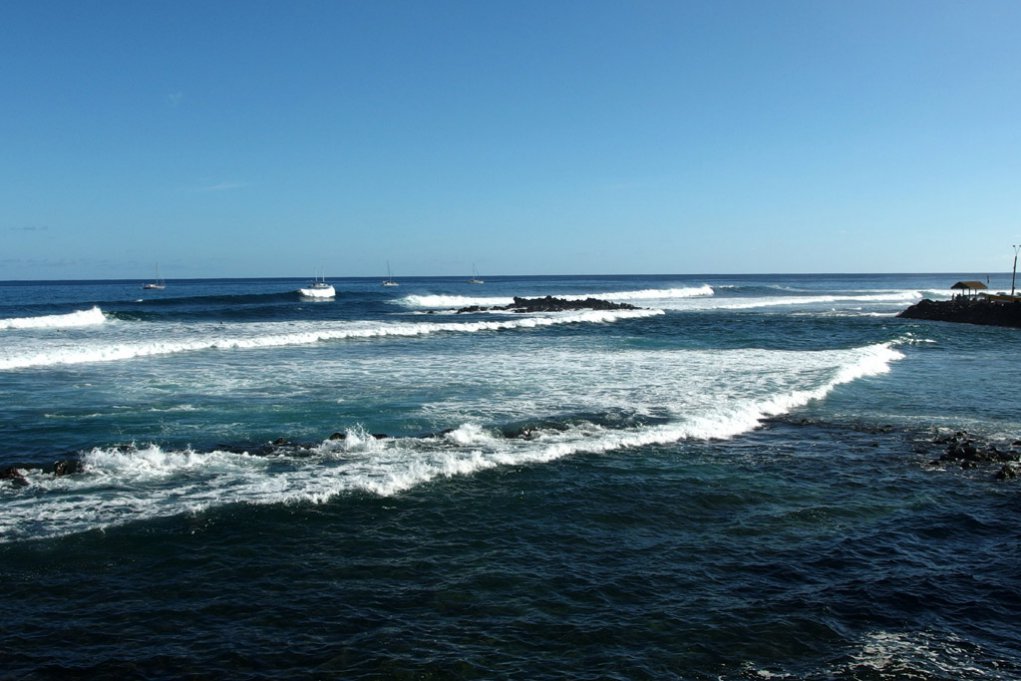
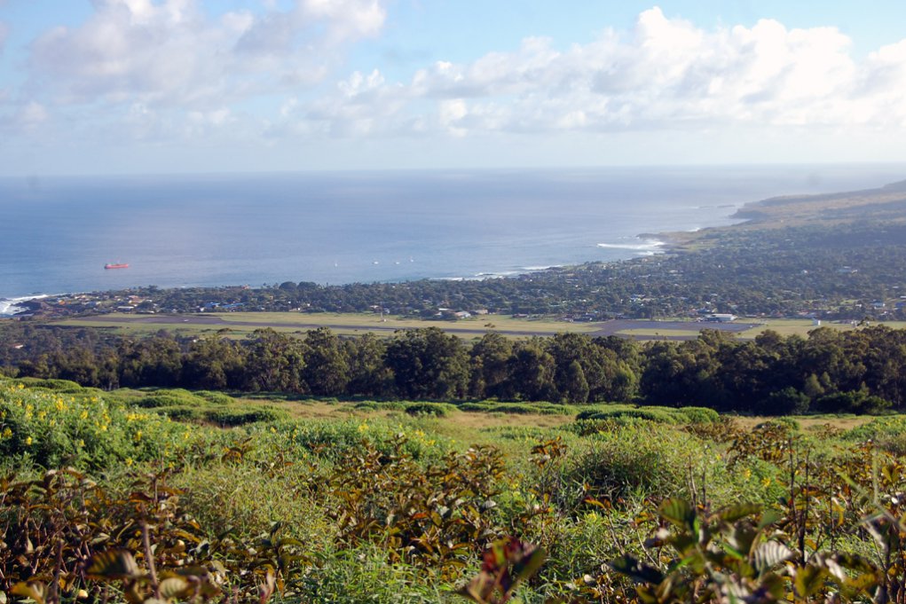
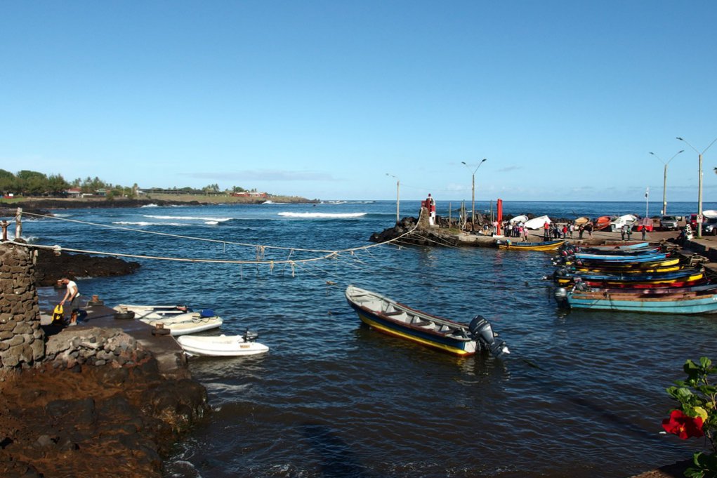
We anchored in front of the only village on the island – Hanga Roa. There are two small harbors were small fishing boats are secured. You can only go ashore with small boats and because of swells this is always very complicated. For us going ashore was always a little adventure. Usually you have to surf into the small harbor between two breaking waves. One time during our stay the harbor was even closed due to high waves and no dinghy was allowed to go in or out. Some of the sailors capsized with their dinghy or were rolled over by high waves in the entrance. We were able to make it ashore without an accident, our strong dinghy motor was definitely an advantage.
We wanted to stay a few weeks but since the next bad weather system would be coming soon we had only a few days to explore the island. The best is to rent a car at one of the many car rentals. At some you can even rent a motorbike. The National Park entrance fee is $60.- per person. But only payable once for your whole stay.

.jpg)
Very spectacular is the biggest crater of the island called Rano Kau, which was our first stop. The crater lake alone has a diameter of over 1 km, where part of it seems to be missing on the ocean side – the „bite“ called Kari Kari. The lake surface is covered with mats of freshwater reeds (Scirpus californicus) which is a rest of the original vegetation. This reed was used by the native inhabitants for example to build the characteristically boat-shaped houses (Paenga-house) and are also found on Lake Titicaca in Peru. In old times the lake was the main freshwater reservoir of the island. In soil samples taken on the far side of Rano Kau in 1965, bacteria were discovered which produced a substance called Rapamycin. It is now produced synthetically and is used as immunosuppressant drug to prevent for example the rejection of organs after transplants. More recently it has been said to slow down the agening process of some single cells – a key to eternal youth?! We expect to hear more of this medicine in the future.
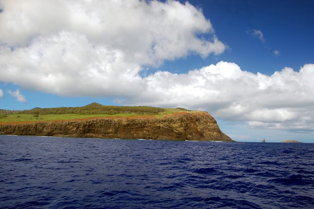
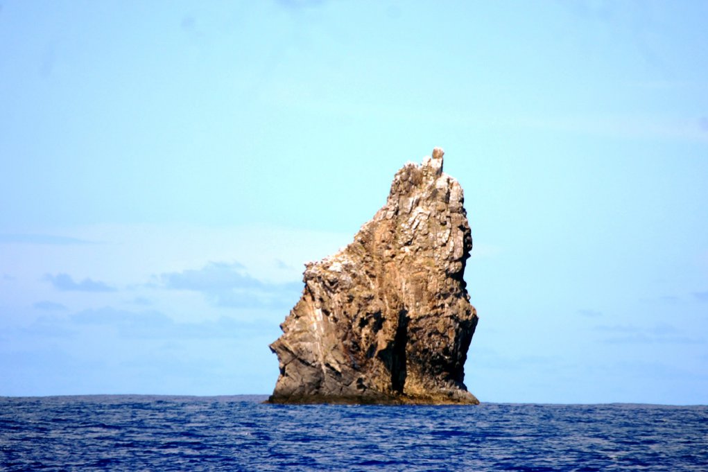
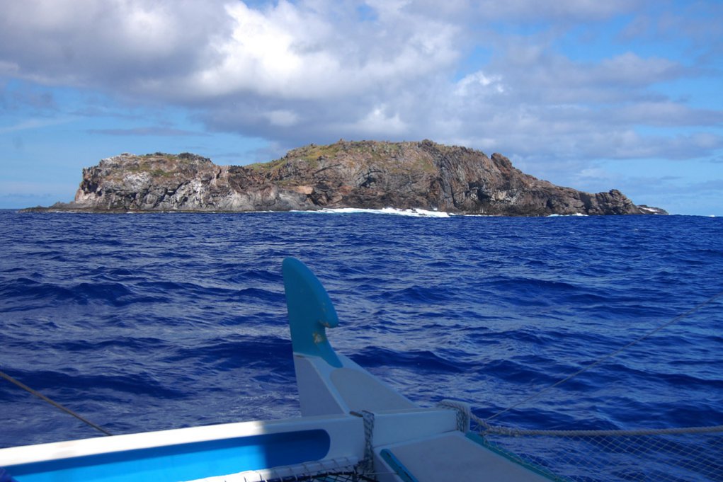
On Rano Kau you can also find Orongo, the place for the ceremonies during the famous birdman competition. Especially the steep cliffs here are fascinating, since the participants in the competition had to climb down with their floats and food to paddle across the ocean to the small island of Motu nui, where they had to wait for the first Noddie egg to be layed. It must have been a spectacular competition which was almost forgotten. During circumnavigating around the island we were able to really see the steep cliffs and to wonder how anybody was able to climb them down, or even worse, climb them up.
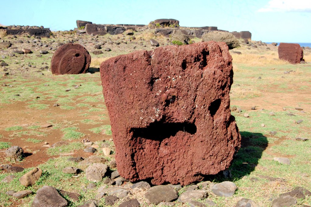
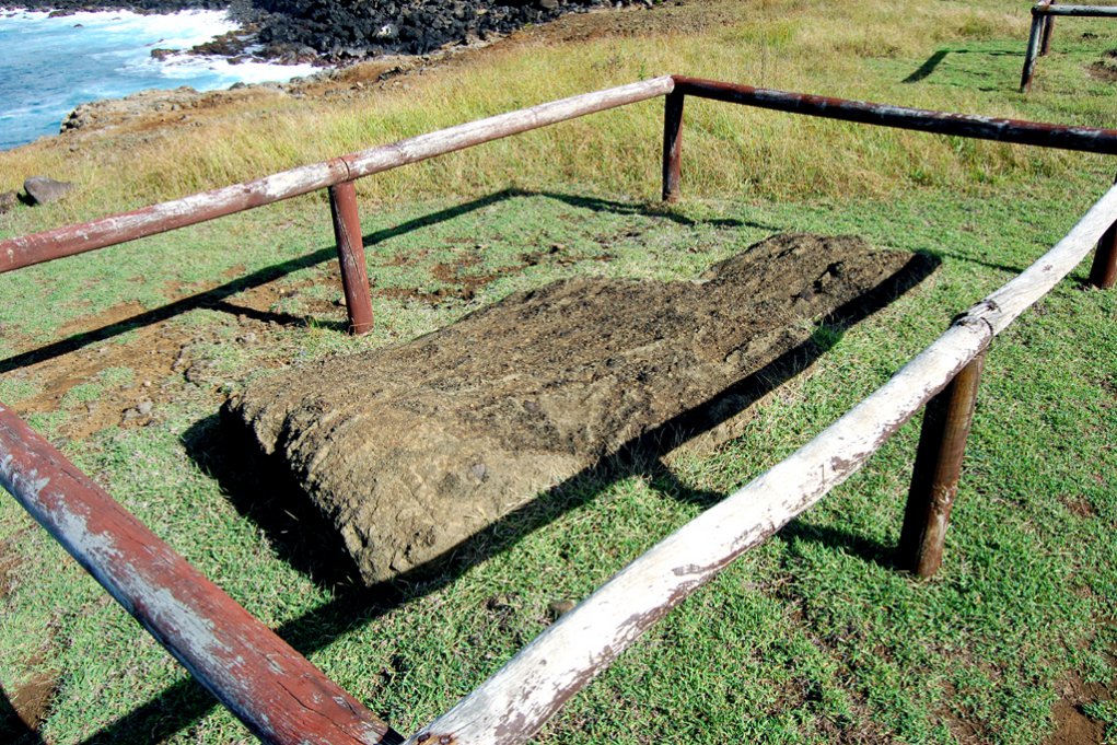
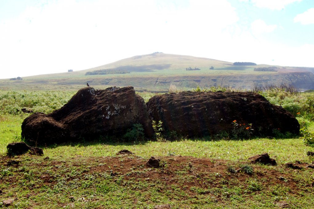
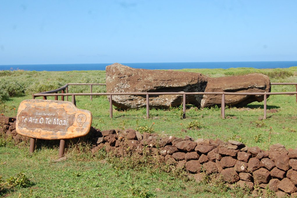
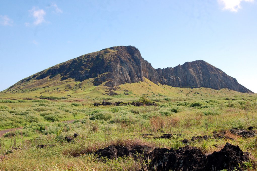
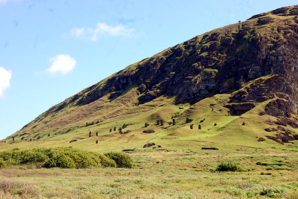
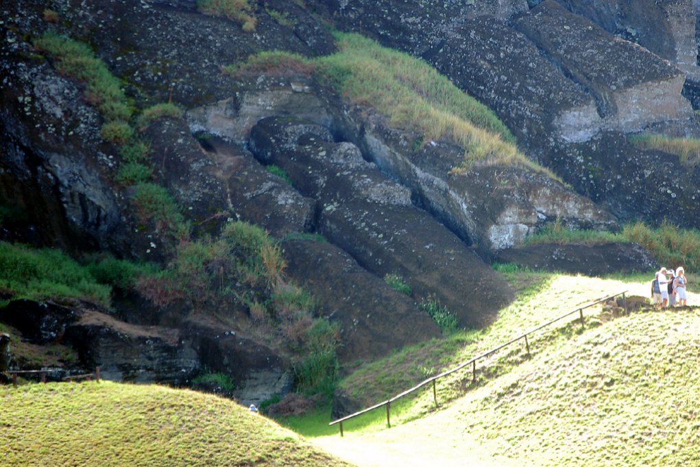
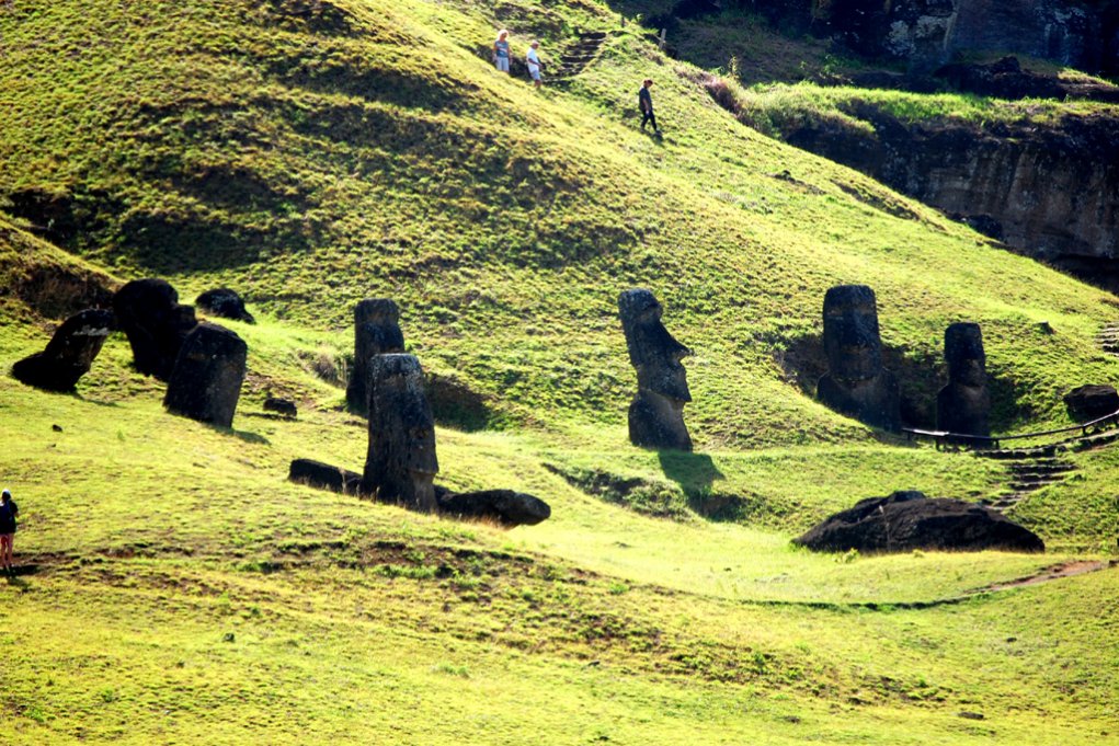
Further stops brought us along the southern coast past many overturned Moai and their red topknots to the famous quarry of Rano Raraku, where all Moai were made. Only here the stone was good enough for building Moai and those then were transported from here to all parts of the island. It still is not clear how exactly this transport was done. In the quarry one can see 397 Moai in various stages of carving. Also the biggest Moai on the island which was never completed, with a length of 21 m.
.jpg)
.jpg)
.jpg)
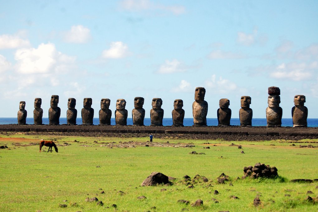
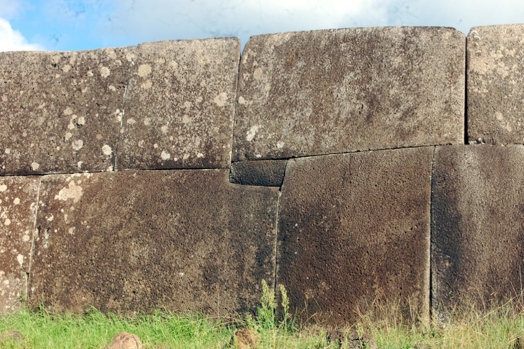
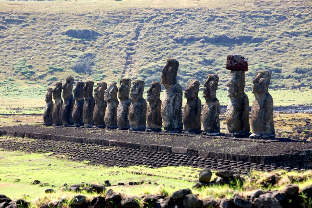
The most impressive sight is definitely the biggest and restored platform of Ahu Tongariki. There 15 impressive Moai stand on the 220 m long platform just in front of a bay. To see the sunrise here must be spectacular, but since the weather for us was unpredictable, we were not able to enjoy a sunrise. Nevertheless it is a magical place. At the entrance you can see the „Traveling Moai“ which was sent to Japan for an exhibition and now is back on Easter Island, hence the name. Only with the help of the Japanese Government, which spent over 2 mill. Dollar, together with a private construction company, which sponsored a crane to lift the statues, was it possible to restore the platform to it's former glory. In any case a place to spend some time and feel the history of the island.
.jpg)
.jpg)
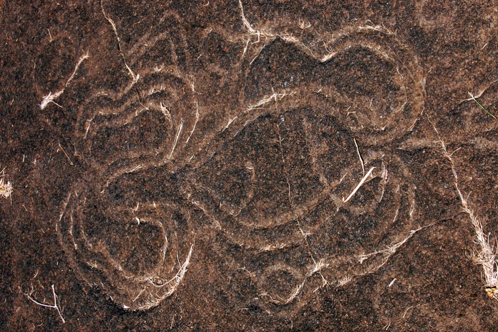
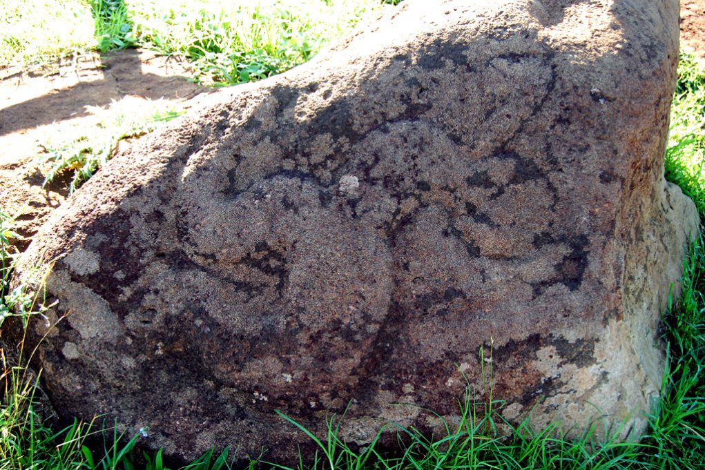
On the northern side of the island there are a lot of places to see so called Pteroglyphs, which are drawings on stones. Especially at Papa Vaka, where you can see the largest pteroglyph in form of a 12 m long canoe. Anakena is also interesting because it is the largest sandy beach of the island where the first Polynesian settlers must have arrived. When we visited, the space under the palm trees was full of Easter Islanders, who were having a picnic there. On the east side of the beach you can also see a platform with Moai.

.jpg)
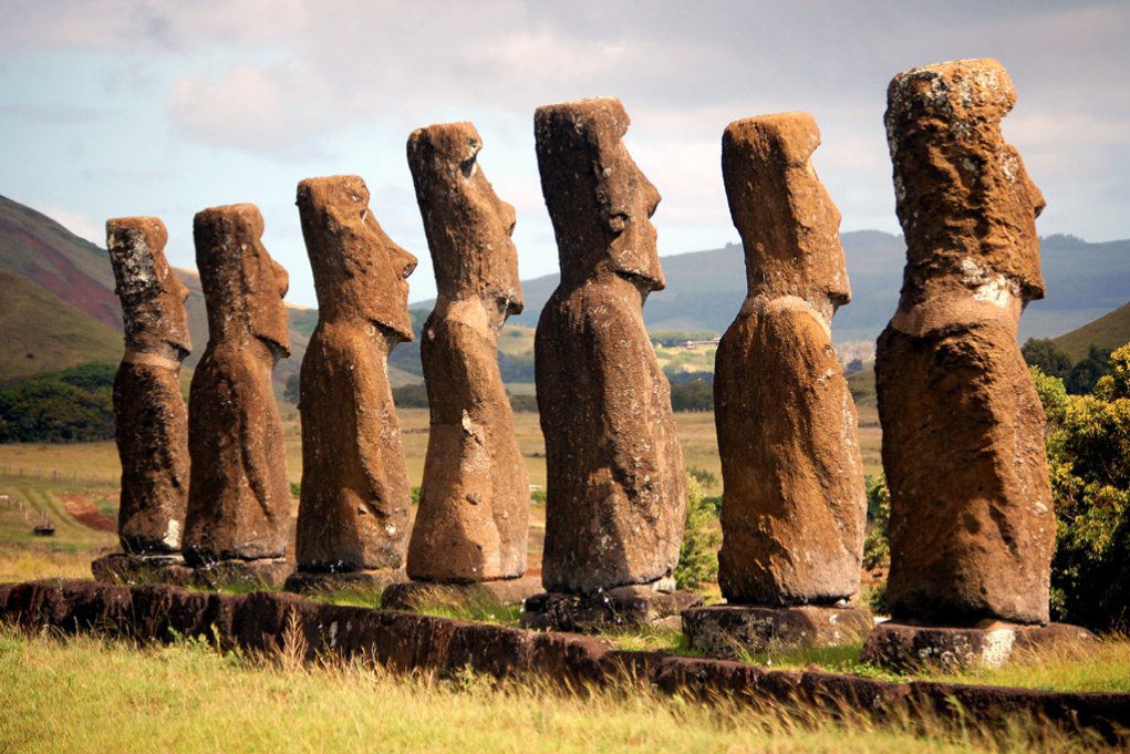
Very interesting are also the 7 Moai of Ahu Akivi in the middle of the island. They are the only ones which seem to look towards the ocean. This is not correct since all Moai actually look towards the village to which they belong. Lately they also found ruins of a village in front of Ahu Akivi. All 7 Moai here look very similar so it is believed they have been erected at the same time. The most fascinating thing about Akivi is that the platform is actually aligned with certain stars on the spring and autumnal equinoxes. The change of the seasons was always very important for the farmers on the island.
The strangest thing of the island is probably the fact that there are still almost no trees on the island. There have been a lot of studies and papers about this and now we know, that before the Polynesian settlers arrived there were millions of palm trees growing all over the island. Most of them endemic and now extinct. Because of the cutting down of the trees and the Polynesian rats which fed on the nuts, those palm trees and all other trees disappeared in time. But even though the trees were gone the people were able to survive somehow on this isolated island. There is a good summary of the history in the book „Collapse“ of Jared Diamond (also of other cultures who disappeared). Whoever wants to visit the island should buy the book „A companion to Easter Island“ from James Grant-Perkin for the visit. Not too long but with a lot of good and valuable information and details of the different sites on the island. It is even available in the only bookstore on Easter Island.


After our round trip it was time to leave the island because of the bad weather coming towards us from the south. So we cleared out and went to the south anchorage to wait for the shifting winds to start our trip towards Gambier in French Polynesia. This allowed us to see the island from every side and wonder how people survived here for such a long time.
Newest Information: At the end of September the government in Chile decided to establish a 720.000 km² large marine protected area around Easter Island, to protect the endemic animals in the ocean and stop illegal fisheries. A success for our oceans!
 >>planned route - join us ...